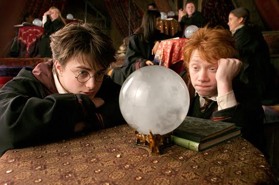
Looks like your weather Howler, is screaming its way to my neck of the woods...

Winter Storm Warning
URGENT - WINTER WEATHER MESSAGE
NATIONAL WEATHER SERVICE QUAD CITIES IA IL
930 AM CST SUN JAN 26 2014
...HIGH IMPACT BLOWING SNOW AND LIFE THREATENING COLD THROUGH
EARLY NEXT WEEK...
.VERY STRONG NORTHWEST WINDS OF 25 TO 45 MPH IN THE WAKE OF A LOW
PRESSURE SYSTEM WILL CREATE WIDESPREAD BLOWING AND DRIFTING
SNOW THIS MORNING INTO EARLY AFTERNOON ALONG AND NORTH OF I-80
WITH PERIODS OF WHITE OUT CONDITIONS AT TIMES. THE WINDS MAY
DIMINISH SOME THIS AFTERNOON...BUT THIS WILL ONLY BE TEMPORARY.
A VERY STRONG ARCTIC COLD FRONT WILL ARRIVE LATE THIS AFTERNOON
WITH MORE STRONG WINDS OF 25 TO 35 MPH...GUSTING TO 50 MPH. THESE
STRONG WINDS WILL CREATE ADDITIONAL WIDESPREAD BLOWING AND
DRIFTING SNOW RESULTING IN WHITE OUT CONDITIONS THIS EVENING POSSIBLY
LINGERING OVERNIGHT. TONIGHT...WIND CHILLS WILL DROP TO BETWEEN 20
BELOW AND 40 BELOW ZERO AFTER MIDNIGHT. TRAVEL CONDITIONS WILL
BE DANGEROUS DUE LIFE THREATENING WIND CHILLS AND REDUCED VISIBILITY
FROM BLOWING SNOW THROUGH MONDAY MORNING.
BITTER COLD WEATHER AND DANGEROUSLY WIND CHILLS WILL CONTINUE
MONDAY NIGHT THROUGH TUESDAY.
IAZ054-064>068-ILZ001-002-007-009-015>018-262330-
/O.EXT.KDVN.WS.W.0002.140126T1530Z-140127T2100Z/
JACKSON-JOHNSON-CEDAR-CLINTON-MUSCATINE-SCOTT-JO DAVIESS-
STEPHENSON-CARROLL-WHITESIDE-ROCK ISLAND-HENRY IL-BUREAU-PUTNAM-
INCLUDING THE CITIES OF...MAQUOKETA...IOWA CITY...TIPTON...
CLINTON...MUSCATINE...BETTENDORF...DAVENPORT...GALENA...
FREEPORT...MOUNT CARROLL...
STERLING...ROCK FALLS...MOLINE...
ROCK ISLAND...KEWANEE...PRINCETON...HENNEPIN
930 AM CST SUN JAN 26 2014
...WINTER STORM WARNING NOW IN EFFECT UNTIL 3 PM CST MONDAY...
* TIMING...BLOWING AND DRIFTING SNOW WITH WHITE OUT CONDITIONS AT
TIMES THROUGH TONIGHT. DANGEROUS WIND CHILLS DEVELOPING THIS
EVENING...CONTINUING THROUGH EARLY AFTERNOON MONDAY.
* WINDS...NORTHWEST 25 TO 35 MPH WITH GUSTS TO 50 MPH THROUGH
SUNDAY NIGHT WITH A TEMPORARY DECREASE IN WINDS FOR A TIME THIS
AFTERNOON AHEAD OF A VERY STRONG ARCTIC FRONT.
* VISIBILITIES...BLOWING SNOW WILL RESULT IN VISIBILITIES BELOW A
QUARTER MILE AND NEAR ZERO AT TIMES ESPECIALLY IN OPEN AREAS
THROUGH TONIGHT.
* TEMPERATURES...FALLING FROM THE TEENS SUNDAY NIGHT TO BETWEEN
5 BELOW AND 15 BELOW MONDAY.
* WIND CHILL READINGS...20 BELOW TO 30 BELOW ZERO SUNDAY NIGHT
THROUGH MONDAY. AS LOW AS 35 TO NEAR 40 BELOW ZERO MONDAY
MORNING.
* IMPACTS...A COMBINATION OF STRONG WINDS OVER FRESH SNOW WILL
CREATE WIDESPREAD BLOWING SNOW...AND DANGEROUSLY COLD WIND
CHILLS. DANGEROUSLY COLD WIND CHILLS WILL LINGER THROUGH THE
DAY MONDAY.
PRECAUTIONARY/PREPAREDNESS ACTIONS...
A WINTER STORM WARNING HAS BEEN ISSUED FOR VERY STRONG WINDS THAT
WILL RESULT IN VERY LOW VISIBILITIES DUE TO BLOWING SNOW...ALONG
WITH DANGEROUS WIND CHILL READINGS. THIS COMBINATION WILL MAKE
TRAVEL VERY DANGEROUS OR IMPOSSIBLE. TRAVEL ONLY IN AN EMERGENCY
AND TAKE YOUR WINTER STORM SURVIVAL KIT.
Hazardous Weather Outlook
HAZARDOUS WEATHER OUTLOOK
NATIONAL WEATHER SERVICE QUAD CITIES IA IL
1045 AM CST SUN JAN 26 2014
IAZ040>042-051>054-063>068-076>078-087>089-098-099-ILZ001-002-007-
009-015>018-024>026-034-035-MOZ009-010-271045-
BUCHANAN-DELAWARE-DUBUQUE-BENTON-LINN-JONES-JACKSON-IOWA-JOHNSON-
CEDAR-CLINTON-MUSCATINE-SCOTT-KEOKUK-WASHINGTON-LOUISA-JEFFERSON-
HENRY IA-DES MOINES-VAN BUREN-LEE-JO DAVIESS-STEPHENSON-CARROLL-
WHITESIDE-ROCK ISLAND-HENRY IL-BUREAU-PUTNAM-MERCER-HENDERSON-
WARREN-HANCOCK-MCDONOUGH-SCOTLAND-CLARK-
1045 AM CST SUN JAN 26 2014
THIS HAZARDOUS WEATHER OUTLOOK IS FOR PORTIONS OF NORTH CENTRAL
ILLINOIS...NORTHWEST ILLINOIS...WEST CENTRAL ILLINOIS...EAST
CENTRAL IOWA...NORTHEAST IOWA...SOUTHEAST IOWA AND NORTHEAST
MISSOURI.
.DAY ONE...TODAY AND TONIGHT
A WINTER STORM WARNING AND WIND CHILL ADVISORY ARE IN EFFECT FOR
PORTIONS OF THE AREA INTO MONDAY. PLEASE REFER TO OUR WINTER WEATHER
PRODUCTS FOR SPECIFIC INFORMATION.
STRONG NORTHWEST WINDS OF 25 TO 35 MPH GUSTING TO 50 MPH IN THE WAKE
OF A LOW PRESSURE SYSTEM WILL COMBINE WITH FRESHLY FALLEN SNOW TO
PRODUCE CONSIDERABLE BLOWING AND DRIFTING SNOW WITH WHITEOUT CONDITIONS
AT TIMES NEAR AND NORTH OF INTERSTATE 80 THIS MORNING INTO EARLY
AFTERNOON. CONDITIONS MAY IMPROVE FOR A TIME THIS AFTERNOON BUT THIS
IMPROVEMENT WILL ONLY BE TEMPORARY AS A VERY STRONG ARCTIC FRONT
WILL MOVE THROUGH THE AREA FROM LATE AFTERNOON THROUGH EARLY
EVENING. THIS WILL BRING A RENEWED ROUND OF STRONG WINDS 25 TO 50
MPH PRODUCING NEAR BLIZZARD CONDITIONS AT TIMES. IN ADDITION...THIS
FRONT WILL BE ACCOMPANIED BY VERY STRONG SNOW SHOWERS WHICH WILL
PRODUCE PERIODS OF NEAR BLIZZARD CONDITIONS OVER THE SOUTHERN HALF OF
THE OUTLOOK AREA LATE THIS AFTERNOON AND EVENING.
THE STRONG WINDS WILL ALSO USHER IN DANGEROUSLY COLD AIR WITH LIFE
THREATENING WIND CHILLS OF 20 TO 40 BELOW ZERO DEVELOPING THIS EVENING
AND CONTINUING THROUGH MONDAY.
.DAYS TWO THROUGH SEVEN...MONDAY THROUGH SATURDAY
A WINTER STORM WARNING AND WIND CHILL ADVISORY ARE IN EFFECT FOR
PORTIONS OF THE AREA THROUGH EARLY MONDAY AFTERNOON.
STRONG NORTHWEST WINDS WITH BLOWING SNOW GREATLY REDUCING
VISIBILITIES WILL CONTINUE ALONG AND NORTH OF INTERSTATE 80 INTO
MONDAY AFTERNOON CREATING DANGEROUS TRAVEL CONDITIONS. BITTERLY COLD
TEMPERATURES AND LIFE THREATENING WIND CHILLS ARE EXPECTED OVER
THE ENTIRE AREA FROM MONDAY THROUGH TUESDAY NIGHT. TEMPERATURES
DURING THIS TIME WILL BE NEAR OR BELOW ZERO WITH WIND CHILLS
FREQUENTLY IN THE 20 TO 40 BELOW RANGE.
.SPOTTER INFORMATION STATEMENT...
ANY REPORTS OF WHITEOUT OR NEAR BLIZZARD CONDITIONS WOULD BE
APPRECIATED.


 Great!
  We can get a bunch of us together and have a party! I have a spare room. I bet Paint can drive over. Loony's just down the road a piece. Maybe Sixxy will go ahead and try on this Continent. We should talk Tonks into trying it on, too. And its too dry where Tracy is, she should come this way. Who else can we get to be here?